An End-to-End summary

This blog documents, in photographs and prose, a walk of about 1300 miles, mostly on footpaths and avoiding roads, from Lizard Point to Dunnet Head. This was undertaken in two stages in 2018 & 2019. The table below provides easy access to each daily blog-entry, but there’s also pre-amble and ancillary information to help others on their way through this green and muddy land.

[Distances and duration were recorded on GPS, unless in blue, where the planned map-distance is stated]

DayBlog entry / walk sectionKm (GPS)Duration
0To The Lizard
1Lizard to Porthleven28.39:05
2Porthleven to Penzance257:28
3Penzance to St Just (Land’s End day)25.58:10
4St. Just to Zennor20.97:03
5Zennor to Hayle18.26:40
6Hayle to St. Agnes32.28:46
7St Agnes to Newquay28.18:25
8Newquay to Mawgan Porth113:12
9Mawgan Porth to Rock24.67:03
10Rock to Port Isaac22.16:46
11Port Isaac to Boscastle22.58:57
12Boscastle to Bude28.59:39
Bude rest day
13Bude to Elmscott24.48:16
14Elmscott to Clovelly22.27:39
15Clovelly to Bideford23.87:58
16Bideford to Barnstaple18.34:35
17Barnstaple to Challacombe21.56:18
18Challacombe to Exford25.28:15
19Exford to Roadwater27.18:09
20Roadwater to Bridgwater39.711:41
Bridgwater rest day
21Bridgwater to Street27.47:28
22Street to Wells20.95:48
23Wells to Blagdon26.97:50
24Blagdon to Bristol29.88:59
25Bristol to Chepstow31.88:50
Chepstow rest day
26Chepstow to Monmouth28.87:36
27Monmouth to Pandy29.38:12
28Pandy to Hay-on-Wye25.87:03
29Hay-on-Wye to Kington26.27:30
30Kington to Knighton236:45
Knighton rest day
31Knighton to Wilderhope Manor42.411:38
32Wilderhope Manor to Coalport24.76:28
33Coalport to Penkridge37.69:52
34Penkridge to Abbots Bromley29.37:33
35Abbots Bromley to Uttoxeter11.93:46
36Uttoxeter to Alstonefield31.79:02
37Alstonefield to Youlgreave226:22
38Youlgreave to Hathersage29.1
39Hathersage to Langsett31.2
40Langsett to Marsden29
An indefinite pause
Back in the saddle
41Marsden to Hebden Bridge24.97:57
42Hebden Bridge to Icornshaw
43Ickornshaw to Airton
44Airton to Horton in Ribblesdale
45HIR to Hawes22
46Hawes to Tan Hill Inn25.7
47Tan Hill Inn to Middleton in Teesdale26.4
48Middleton in Teesdale to Langdon Beck13.1
49Langdon Beck to Dufton20.1
50Dufton to Alston31
Rest day in Alston
51Alston to Once Brewed28.67:06
52Once Brewed to Bellingham26.27:05
53Bellingham to Byrness267:31
54Byrness to Jedburgh34.38:57
55Jedburgh to Melrose29.27:58
Melrose rest day
56Melrose to Innerleithen29.57:58
57Innerleithen to Peebles12.12:53
Back home again
Almost eleven months break
58Peebles to West Linton23.57:18
59West Linton to Uphall33.49:00
60Uphall to Linlithgow16.23:40
61Linlithgow to Castlecary
62Castlecary to Strathblane
63Strathblane to Drymen
64Drymen to Callander
65Callander to Killin
Killin rest day
66Killin to Bridge of Balgie
67Bridge of Balgie to Bridge of Gaur
68Bridge of Gaur to Loch Treig
69Loch Trieg to Spean Bridge
Spean Bridge rest day
70Spean Bridge to Beinn Mheadhoin
71Beinn Mheadhoin to East Glenquoich Forest
72East Glenquoich Forest to Glen Affric
73Glen Affric to Maol-bhuide
74Maol-bhuide to Craig
75Craig to Kinlochewe
Kinlochewe rest day
Kinlochewe rest day 2
76Kinlochewe to Shenavall
77Shenavall to Douchary
78Douchary to Oykel Bridge
79Oykel Bridge to Glen Cassley
80Glen Cassley to Crask
Crask rest day
81Crask to Gearnsary
82Gearnsary to Kinbrace
83Kinbrace to Dalganachan
84Dalganachan to Watten
85Watten to Keiss
86Keiss to John O’Groats
87John O’Groats to Dunnet Head
The end-to-end walking route. There are additional Zoomable Google Maps of the planned route.

Day 87 John O’Groats to Dunnet Head

27th May 2019

Weather: Lots of blue sky and sunshine. Cold onshore Northerly wind.

Setting off at 8:15 the day welcomed me with a brief shower that drifted away towards Dunnet Head. I was fed up with road walking after two miles so tried to find a route along the shore at Huna. Rocky beaches, nettles and a shock from an electric fence made me give up at Kirkstyle and it was another two miles of road until Mey Hill where I could relax on a quieter road, then a decent shoreline path. I resisted the temptation to call in at Mey Castle for the tea rooms.

Layered rock formations, sunlit views across the sea to the cliffs of Dunnet Head, my beckoning target. Disturbing wildlife as I went: a seal shuffled into the sea with a splash; a skylark doing her proper thing of flying higher and higher; terns in shrieking turmoil as I sat for lunch.

A stop at the appropriately named Windhaven Cafe for chocolate, at the base of the climb to Dunnet. I overheard a family discussing my walking gear as “that’s the way to do it”. The last 3km was a grass-and-heather trail occasionally signposted “North Highlands Way”, close to cliffs with the giveaway pong of nesting seabirds below and the investigating flights of fulmars above.

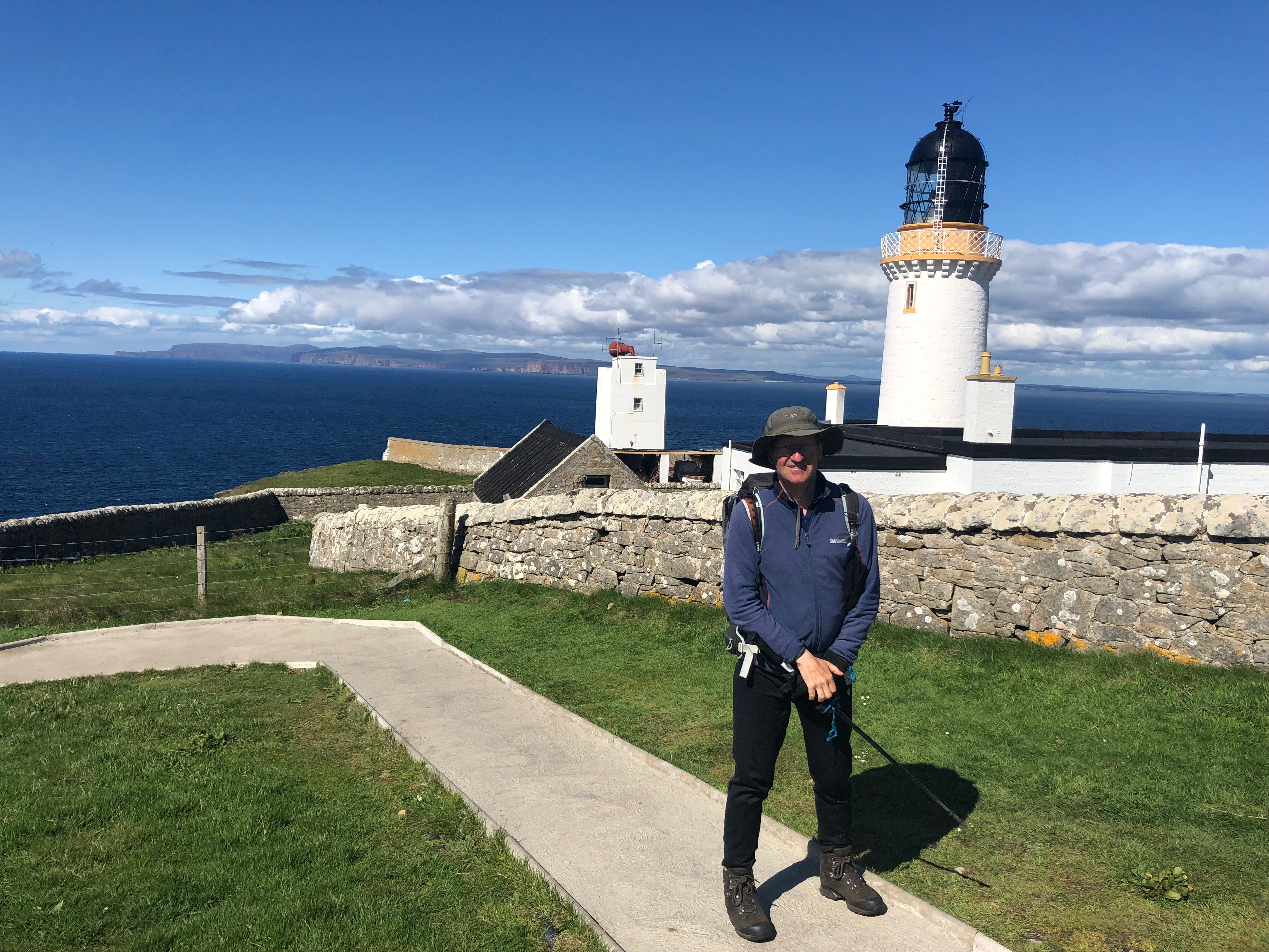
Around 4pm I arrived at the viewpoint South of Dunnet Head lighthouse, with great views along the coast to Cape Wrath and the peaks I was closer-to a week ago: Ben Klibreck and the now familiar silhouette of Morven and the group I had seen since Dalnawillan and Watten. Views also across to Orkney, with big cliffs and the stack of Hoy clearly visible.

I asked a couple to photograph me there (who said they wouldn’t be home for 3 weeks) , and a few minutes later near the lighthouse by another person (Ross) who mailed me some pictures: thanks so much!!

file
By Dunnet Head lighthouse

So: Dunnet was done and “The Quest” complete. 12 miles in about 7.5 hours, with fence-climbing and a faff on beach-rocks, as well as the cafe stop. Another enjoyable day, with great weather for walking and the bonus of dry feet – the first time since Kinbrace.

The next thing was to start the trip home. The walk along the road back to the cafe gave different views to ones from the clifftop: the lochs and heather of Dunnet Head all bathed in sunshine that I hadn’t seen since Kinlochewe to Shenavall. Hitching a lift had been unsuccessful until, just past the cafe, Tommasio and Marica from Italy gave me a lift. We talked in a mixture of Italian (thank you Mrs Sharman!) and English the 120 miles to Inverness, arriving 7:30. Many thanks to them both for helping me to be in an easy place to take trains the next day and be home by 6:30pm


Day 86 Keiss to John O’Groats

26th May 2019

Weather: Cloudy. Mid-morning to early afternoon was clear of rain. Easterly on-shore wind.

The previous evening forecast suggested that I should take a day off to avoid all-day rain. I woke at 5 am, packed and watched the 5:45 and 6am forecasts on TV. They told me it was raining outside (it wasn’t) and would be raining heavily in the afternoon and evening. The deciding factor though was a good forecast for Monday 27th: a) Finishing on a sunny day would be a treat  b) Today’s rain cannot be any worse than I have already experienced.

I set off at 06:15, and what a fabulous day it was. Castles, brochs, extraordinary sea-cliff formations, sea birds, including puffins. A beautiful walk, not at all demanding.

Keiss Broch clearly had some modern amendments to it, some odd statuary with a figure looking out to sea. The ancient version of Keiss Castle is perched on precipitous cliffs with warning notices telling people not to walk on the seaward side!

keiss castle
Keiss castle (not my photo)

As I travelled Northwards the coastal cliffs gradually increased in height. They are made of layered rock, providing platforms and niches for, probably thousands of, seabirds’ nests. I felt guilty at disturbing them, as they flew out to investigate me: the fulmars (cute rounded heads and beaks) just hanging in the breeze a couple of metres away from my head;

Northern_Fulmar_(Fulmarus_glacialis)_in_flight (from Wikipedia commons)

puffins with their orange feet hanging as they swerved by. There were guillemots, and/or razorbills all crowded together on the lowest platforms near the sea. The nests were so close to me, sometimes, as I looked down the cliff-gullies. If you didn’t know the birds were there, you would at least wonder where the smell was coming from.  All above the cliff tops, and on some of the less-precipitous slopes: whole carpets of pink thrift.

The map named a series of rock formations as “Geo”s: small ravine-like bays with increasingly higher rock stacks. With names such as “Hobbie Geo”, “Samuel’s Geo”, “Selly Geo” it was obvious to wonder on the origin of their naming. “Wife Geo”: a most spectacular arrangement of tall cliffs resulting in an ovoid amphitheatre required only a little imagination to work out its naming once you realised that an “old man” (rock stack) was set in its centre. 

It was here that I met a chap walking his dogs. He moved to Duncansby 22 years previously, said it was “even better than I expected it”. He loves watching the seabirds, and even admired the severe winter storms that had driven away other people who had also tried living in the area.

There were rock arches too. The next treat was the “Stacks of Duncansby”. The common photo is taken from Duncansby head (North of the stacks) where they look like two cones. Coming from the South, the most Northerly stack looks like a pencil: a wall that is leaning over at an unfeasible angle.

duncansby stacks
Duncansby stacks from Duncansby Head (photo from https://www.undiscoveredscotland.co.uk)

Duncansby Head is notable for the lighthouse and its view across to the Orkneys. Arriving about 12:00 this was the only part of the day when looking North was less clear than looking South, as the rain had resumed. There was a group of people with telescopes trained Northwards: I stopped to ask if they were whale-watching. They were, and had spotted Orcas that morning, then a large pod of whales (pilot I think they said) yesterday.

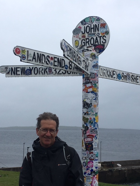
A walk along the coastal fringe to Ness of Duncansby, I arrived at John O’Groats about 1:10 pm. Many thanks to Mike and Pauline, who did me a great favour of taking the iconic pictures at the JOG “totem pole” and emailing them to me.

IMG_2379

IMG_2380

It proceeded to rain for much of the afternoon and evening, so I was more than happy with my 6am decision.

About 12 miles of unhurried walking in 7 hours.


Day 85 Watten to Keiss

25th May 2019

Weather: Cloudy, occasional light rain.

Stuffing my boots with newspaper last night, the cracks at the insteps explained the inability to keep my feet dry on wet ground. I tried to calculate how many miles I have walked in these  boots (on this adventure the HanWag Tatra boots took over in Grindleford in 2018) and reached about 900, but at the finish of this trip, so no more than 800 miles before the leaks began. Is that good or bad? Just how long are a good pair of boots supposed to last?

I was in no hurry this morning, with a planned “short day” of 11 miles. The walk began alongside a river, with a very pastoral scene: green fields; cows; ploughed fields with crops; the occasional fishermen’s hut. There was a short, awkward boggy and tussocky stretch to get to the edge of a forest, with lots of birdsong. I was pleased that I was working well with printed map & compass. A short walk West along the B874 and into another forest, easy track with some squidgy bits.

It all went wrong after leaving the forest to reach “Moss of Killimster”: very rough ground, and no apparent way to cross the deep and too-wide trench that held a river. There was no bridge, and no obvious way to cross, so I kept to the West side. I set the compass to the direction I needed to gain, following the bank. It was very frustrating that I could see the buildings that I needed to reach, about a mile away, but at each attempt to go in that direction, my legs sank into deep, soft vegetation up to my knees. After several attempts I gave up and headed across harder heather-clad ground, 180 degrees in the wrong direction. I still had to endure some sinking vegetation. Reaching a farm I asked where I was: Winless … about 1 mile East of the point I had joined the B874: probably the best part of 2 hours getting practically nowhere. The obvious thing to do was take a big loop on roads. The B876 after Reiss being memorable for fast traffic and a farmer telling me not to walk along his track (to cut out some road) because his black cows were giving birth. The region being a former WW2 airfield RAF Skitten

From Westerloch, a view of the sea and coastline Southwards, plus an enormous pipeline on rails run by Subsea7.  A short while later, after a hop over the sand dunes I was walking along the sandy beach of Sinclair Bay. All too briefly, because the beach and sea is such a restful place. I was hailed by someone as I walked along a rough path on rocks by the rocky shore, but hurried up onto the streets of Keiss, in case I was going to get another telling off for walking in the wrong place. He caught up with me outside the hotel & asked me if I was walking the “John O’Groats Trail” (I had seen a signpost). He told me that he had been walking Lands End to JOG in stages … over the last 30 years. The conversation was interrupted by a man clad in a leather onesie, with holes cut out at the top, asking if I admired his nipples! His stag party was visiting the hotel. I was then interviewed by a man holding a glass of whisky asking me, aggressively and drunkenly if I had ever been to the most beautiful part of Scotland. He seemed satisfied by my confirmation that I had been to Skye.

They departed shortly after that, their coach departing to invade JOG . The rest of the evening was quite tame after that.

A 4:30pm arrival – so much for my short day. An extra 5 miles distance, plus the exertions of the extraordinarily rough ground getting nowhere.

Day 84 Dalganachan to Watten

24th May 2019

Weather: Cloudy. A stiff, cold Westerly wind. No rain.

Happy to see that the rain had stopped, I packed and left the “house of horrors”* swiftly. I had no idea of the time. The footpaths were no longer running with water, and the heavy clouds appeared to be lifting.

dalganachan
(*Not my photo)

The caged dogs by Dalnawillan Lodge (see Flickr photo here from 2014) all ran out to see me, barking. The Lodge was a very imposing building: presumably a Victorian hunting Lodge, now decaying, with a newer house nearby. It seems to be a feature of these remote parts with yet another house, a little further on, also on its way to ruin.

I disturbed several deer, as usual, some who ran across moor and river to get away. After 6 miles I reached Lochmore and looked backed on the silhouettes of hills, invisible yesterday, as I ate a second breakfast of fruit & nuts. After another two miles, at Strathmore Lodge, I spoke to two shepherds in a 4WD and discovered it was 08:25. Given that I had probably set out some 3.5 to 4 hours earlier, I had probably started between 4:30 & 5 am, the daylight hours being long this time of year.

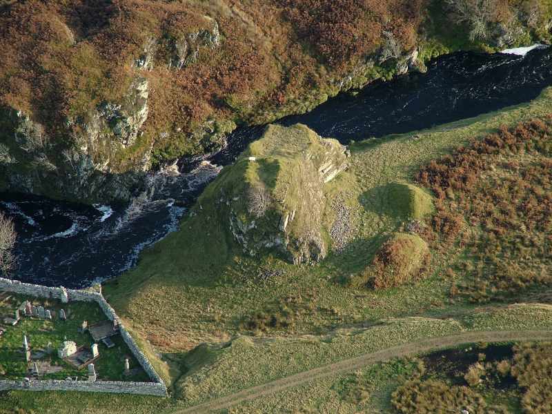
The advice I had received at The Glutt was to walk all the way on the road to Watten rather than risk boggy ground again. But I decided to trust Andy Robinson once more and follow his cross-country route. I was glad I did: it was far more enjoyable to walk on a levee above a wide meandering river near Dirlot with oyster catchers, dippers and an eagle. The small rocky gorge by “Dirlot Castle” was quite a sight, and I walked right past the cemetery without really spotting the “castle” at all.

dirlot9
Dirlot Castle from the air (taken from http://www.caithness.org)

An elderly man driving a small yellow car to the end of a bumpy track (his son had borrowed his expensive 4WD “but for some reason no-one wants to borrow this car”), with a fishing rod strapped between bonnet and roof, stopped to chat. He told me that it was “Charles favourite spot, just over there” (Dirlot Castle), pronouncing Charles as “Char-lez” and that Dalnawillan Lodge used to be frequented by “wealthy people and maharajahs from all over …”. The “private reach is owned by Lord Thurso”, and so on. He spoke of his life in London (originally from Ireland) and delight in retiring to this area.

river thurso
River Thurso (not my photo)

The next stretch was most odd: a small valley, like a trench scraped in the landscape. Clearly an old glacial moraine used as a quarry: the sand and gravel topped by a metre of peat that had rolled off in chunks. I warily kept away from the steep sides to avoid being caught in a “peat-a-lanche”.

Crossing the river was a boots-off-crocs-on job. Crossing the deer fence was harder, but I have been getting used to that. All next to a newly-planted crop of wind turbines at Halsary that made whooshing sounds continually. Then it was a stomp alongside the A9 for 1km, but I kept well away from the road, finding tracks among the tussocks. In the forest, lots of birdsong and a deer with a small fawn. A short trog across rough grass and then along a track and road to Watten, my destination, where I found it was only 2:30pm.

If my calculations are correct I walked 21miles in about 10 hours (including all the usual faff stops, chats, river crossing). It rather shows how much time I previously spent taking photos. An enjoyable day, even though I had wet feet for most of it.

*The pigeon had already left, unlike his freshly-dead predecessor in the kitchen sink the night before. This morning’s discovery of two mummified sheep in the pigeon room crowned the horrors of the night.


Day 83 Kinbrace to Dalganachan

23rd May 2019

Weather: Rain continuously all day of varying intensity, driven by a Westerly wind, fortunately mostly behind me.

I felt intimidated at the very thought of walking across the “Wild Land area” of Knockfin Heights aka Flow Country.  even as I was planning the trip. I was, however, trusting Andy Robinson (the author of the book An End to End Trail) to supply a safe route, and for me to navigate it.

With waterproofs on from the start at Kinbrace station at 09:30, a two mile walk up the road, then the fun started. Traversing rough boggy ground (sedges mean deep standing water, I discovered) on the edge of a felled forest, I learned that walking close to the river provided the best drainage. There was a tricky climb over a deer fence right next to the riverbank.

With a gain in height, crossing rough heather I came across the nest of one of the many crying plovers: four neatly arranged eggs out in the open. I hurried on to an area with a beautifully circular stone sheepfold at Knockfin that would have provided 360 degree wind shelter as a campsite. I gently cursed my lack of resolve yesterday to have gone that little further.

The last ascent before reaching the plateau followed a lively stream, giving a hazy view across the lower ground and cloud-covered hills to the West. A soggy, intermittent, path finally vanished on the boggy plateau, now misty and windswept.

Using my compass I reached a candidate for the ultimate trig-point-bag at 438m on a soggy peat hag, where I hunkered down for a few mouthfuls of food and drink. It reminded me of an early experience on Kinder Scout roller-coasting the peat hags circa 1979/80. With apologies to my companion that day (you know who you are! I hadn’t learned, then, the trick of finding Kinder Gates to gain the easier route).

The easy route out of this one was to find, then follow, an East-flowing river. I succeeded in doing so, but its banks were occasionally defended by large grassy tussocks, one of which tripped me up. I fell sideways, the top section of one walking pole bearing the weight of my landing and snapping off the handle. I endured it by telling myself that this was “the last hard day”, with everything after this being relatively easy.

My curiosity to visit the “Chalybeate Springs” marked on the map was overridden by my desire for this bog-trotting ordeal, in the driving rain, to end. My boots had long since filled with water (the beading of water on the surface told me that the external waterproofing was fine, and that water was entering from the soles). Fortunately my gloves were warm when wet, but they needed wringing out occasionally. The waterproof jacket and trousers were doing their jobs admirably, meaning I was never cold nor wet inside.

I gained a yellow-stoned track (“…follow the yellow-brick road…”) that shortly led to a small valley bearing a full stream. If I thought that the walk across to Crask was the ultimate bog trot, today proved me utterly wrong.

At 3pm I was surprised to come across a hut, looking like someone’s garden summerhouse. I gratefully retreated from the wind and driving rain for a late lunch. I noticed the water on my ‘phone and wiped it down (forgetting to take off the case and doing the job properly). I had still been taking pictures regularly, even in the murky conditions.

The track descended out of the mist and the buildings of The Glutt appeared. Someone came out to let out the dogs from their fenced kennelling and seemed delighted at their freedom. He had seen me coming and stopped me for a chat. A “Derby lad” who “left the rat race when this job came up”. It’s a few miles down the track at the end of the public road, in turn miles from a town. He told me of the need for the rain because the moorland had been so dry, with large fires last year, and that Andy Robinson had visited last year researching an update to the book.

I was keen to move on and get settled for the night. He advised that Dail Righe was the only decent camping area. To go further to Dalnawillan Lodge was “asking for Mark’s dogs” to be barking at me all night.

At 1km short of Dail Righe I came across an abandoned house at Dalganachan, probably around 6.30. To cut the tale short, the place was falling apart, broken windows, holes in the ceiling and the floor covered with animal jet hardened with age.

After escorting out a dead pigeon, my phone decided it had had enough: fizzed, spat, then refused to work. I noticed that the case was full of water (probably my gloves dripping on it each time I took it out of my pocket).

After getting some water from the river in a large beer glass and jug, I found a cleanish platform to lie on out of drafts and drips as well as the ongoing wind and rain.

An almighty din, sometime around midnight I guess, made me jump out of bed fearing large-animal incursion. It turned out to be a pigeon repeatedly flying into a window in another room. After unsuccessfully trying to shoo him out, I left him to continue his ordeal and racket, retreated to bed, put ear plugs in and tried to banish thoughts of “haunted house” from my head.

Day 82 Gearnsary to Kinbrace

22nd May 2019

Weather: Dreich

Heavy rain in the early hours made me grateful for the hut. The nearby river, much fuller than I left it last night, with lots of ‘bits’ in it, made me wish for a water filter.

The low cloud and mist, with occasional drizzly showers wasn’t the worst day I have had. The views of this almost treeless landscape holding large lochs would have been bleak even in good weather.

A “hut circle” marked on the OS map. The two poles mark the higher ground on opposite sides of the ring

Two optimistic fishermen had just headed into the wind across the choppy Loch Badenoch

Lichen on the roadside reflector-poles suggest that it’s often damp here

The pretty meander of the River Helmsdale

Arriving at Kinbrace, in the station shelter, I considered my options over lunch. A further four hours walking would have put me in the middle of flow-country at about 400m: a soggy and foggy prospect today. Alternatively I could have camped nearby for the afternoon and evening: a dreary, poorly-sheltered, prospect

The miracle of 3G in the middle of nowhere had already allowed me to update the blog and now provided the train timetable (none at the station) and weather forecast. I feel I am cheating a little, having taken the train to Thurso with the intention of returning tomorrow, hopefully to better weather and the prospect of a better camping spot for tomorrow night. Yet another easy decision…

Day 81 Crask to Gearnsary

21st May 2019

Weather: Cloudy, mountain tops clearing by midday, clear air, windy.

What a fabulous walk! The track East from Crask is clearly a causeway across the bog, long ago made of piled turf and stones. Only where the drainage had failed were there a couple of boggy bits to navigate. Views for miles back to Crask until just before the bealach.

Once over the bealach, a beautiful view along the loch in a classic glaciated valley with some woodland along the glen slopes.

It joined the larger Loch Choire at a sandy beach.

The hut there was quite well laid out with sleeping platforms, table, chairs, a stove.

Then a very pleasant and easy walk alongside this Loch, overlooked by Ben Klibreck, allowing me to enjoy the views rather than watch every step.

I met nobody all day, climbed two deer-fence basic stiles and managed to steal up close to some deer from upwind. Spotted a sundew plant on the path.

A few sunny intervals, then very light showers began just as I reached the Gearnsary hut.

It’s very basic, with a cobbled floor, no stove. I spent a while sweeping up a spillage of beet pellets before laying down two wooden pallets as a sleeping platform.

Quite what the oversize bird box in the rafters is for I am curious to know.

A noisy West wind is blowing away, slightly rattling the corrugated iron roof.

Crask rest day

20th May 2019

The forecast was drizzle all day and a period of heavy rain at some point (exactly when kept changing) making it tempting to sit out the day. Or was it the tired legs and sore feet from a day and a half of wet socks that persuaded me?

The rest at the Crask Inn has been pleasant, including talking with some visitors.

Last night’s tent

This included Dave & Jackie who walked LEJOG (using the Andy Robinson route) from April 3rd to 6th July 2016. I was sitting quietly in the corner and, spotting my rucksack, they just asked me if I was.

A French motorcyclist (who clearly loves traveling around the UK by bike) nearly made off with one of my drying socks, hitching a ride on his Velcro.

My boots are nearly dry: helped by a spot of sunshine and a strong wind.

The direction I walked in from yesterday

Party atmosphere here tonight as two LEJOG cyclists are finishing tomorrow and their friends have arrived to celebrate.

No room at the inn tonight, this is tonight’s tent

Next update may be a while, but there may yet be a 3G in-the-middle-of-nowhere surprise as here.

Day 80 Glen Cassley to Crask

19th May 2019

Weather: I left the morning’s cloud in the hills on reaching Loch Shin, but they came after me in the afternoon, bringing rain.

My boots still wet since yesterday, I set off wearing waterproof socks.

The morning walk (note cloud)

The locals on the skyline watching me leave

A rough bog trot to start the day: a trackless route across to Loch Shin: an enormous Loch that dictates the route around it.

Loch Shin

Loch Griama from South

A couple of hours of sunshine by the loch on a forestry track,

climbing 2m locked gates at either end

then the greatest bog trot of all – miles across flow country – a huge blanket bog.

The white buildings of Crask Inn about 4km away, loomed over by Ben Klibreck

Mindful of my experience 3 years ago being swallowed by a bog I was careful, and if it hadn’t been so dry since last year it would certainly have been even harder. The dryness of the waterproof socks only lasted a couple of hours.

The Crask Inn beckoned me on: I saw it miles off, tantalising me with its promise of pub food, and my last food parcel. Even better it had a room, although I was expecting to pitch my tent. Just as well – it rained all evening, and tomorrow’s forecast says rain from the afternoon. Not looking forward to that!

Walkers, fishermen and two JOGLE cyclists in, we sat down to a meal together.

My last food-parcel